|
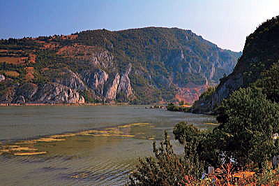
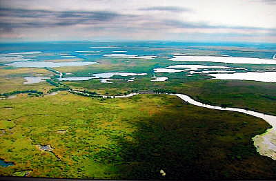
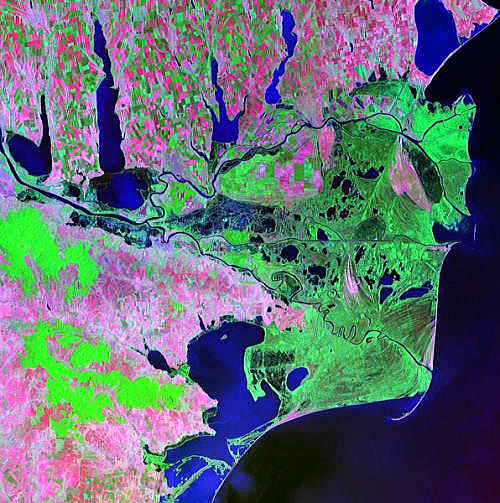
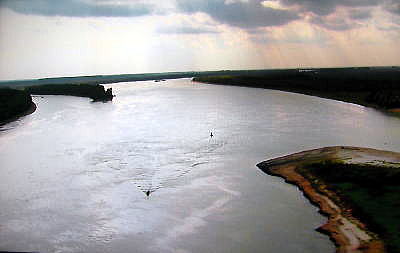
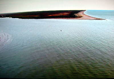
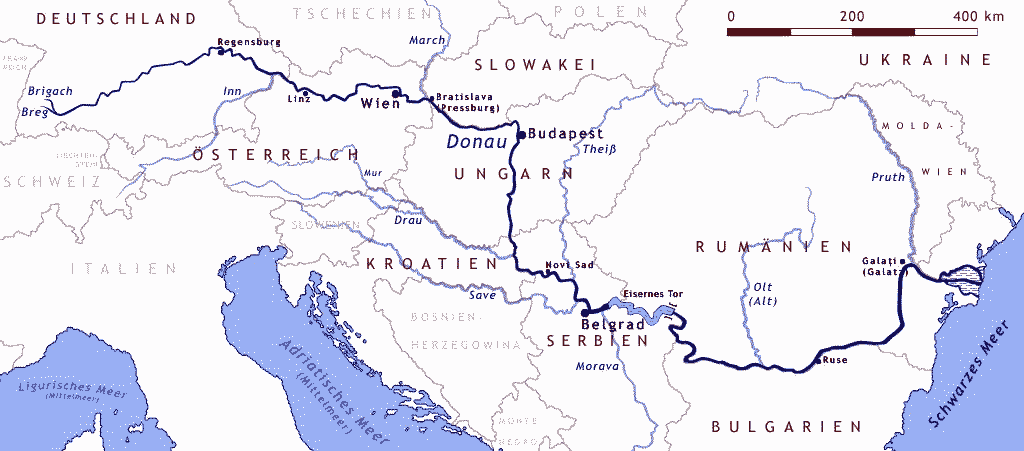
| ① 序論 ドナウ川とは ② ドイツ(始点)からオーストリア ③ スロバキアからクロアチア ④ セルビアからルーマニア(終点) ●セルビアの首都、ベルグラードを流れるドナウ川 下はセリビアの首都、ベルグラードを流れるドナウ川 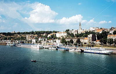 ベルグラードを流れるドナウ川 Source Photos Royalty Free Photograph 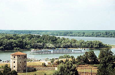 ベルグラードを流れるドナウ川 Source Photos Royalty Free Photograph ●セルビアのゴルバッツ要塞近くを流れるドナウ川 以下はブダペストから南に約300kmにあるセルビアのゴルバッツ要塞 Golubac Fortress。 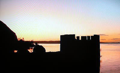 セルビアのゴルバッツ要塞 Golubac Fortress Source:Image of Wien Phil New Year Concert of 2010 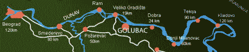 Golubac fortress is under protection of the National Institute for Protection of Cultural Monuments since 1948 and in 1979, it has been categorized as the cultural heritage of exceptional importance. The Fortress is located within the Djerdap National Park. Octagonal Sesir Kula (Eng: Hat Tower), formerly used as a pier of the Fortress, nowadays is the symbol and trademark of Golubac. The first known record of Golubac fortress dates back to 1335 when it was mentioned as Hungarian military fortification although it is not known when precisely it was built or who built it. Byzantines used it to fortify its northern borders; Hungarians to protect its estates across the Danube; Serbs to guard its territory from Hungarian invasions… Due to exceptional geostrategic location, over centuries, many times it was a target of various conquerors and battlefield of different armies. Source:http://www.golubac.rs/en/tours.php 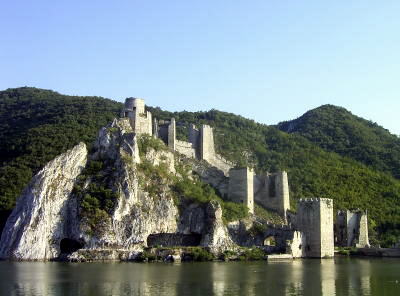 セルビアのゴルバッツ要塞 Golubac Fortress Source:From Wikipedia, the free encyclopedia 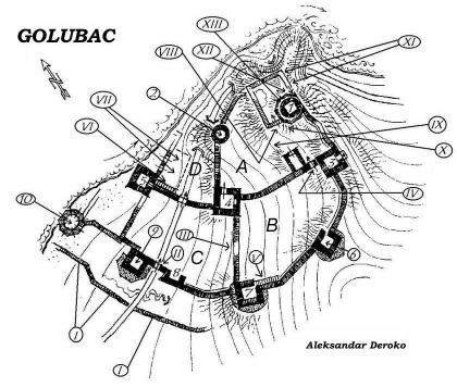 セルビアのゴルバッツ要塞 Golubac Fortressの平面図 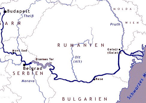 ●セリビアとルーマニアの国境沿いを流れるドナウ川 Eisernes Tor (鉄の門、英語でIron Gate。位置は上の図参照) Eisernes Tor(直訳、鉄の門)は、ドナウ川がカルパティア山脈を横断する部分の峡谷を指す。 Eisernes Torは、広義には134 kmからなる渓谷で地理的にはセルビア共和国とルーマニアの国境の一部をなす。 狭義には東端部のみを指す。東端部はルーマニアの都市オルショヴァの郊外にあり、現在は水力発電目的のダムが建設されている。ダムはルーマニア・ユーゴスラビアの共同事業で、治水を目的に1964年に建設が開始された。1972年に完成、二つの水力発電所と二つの水門が付随している。この鉄門一体は景勝地として著名である。鉄門の周辺はドナウデルタに続く湿地帯となっている。  セルビアの首都ベルグラード近くの鉄の門、Eisernes Tor Source:Image of Wien Phil New Year Concert of 2010 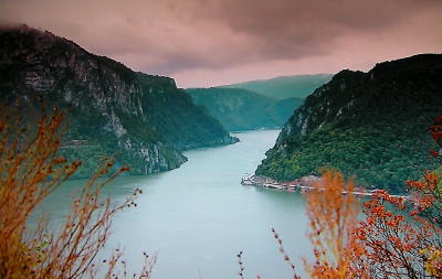 セルビアの首都ベルグラード近くの鉄の門、Eisernes Tor Source:Image of Wien Phil New Year Concert of 2010 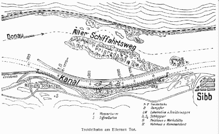 セルビアの首都ベルグラード近くの鉄の門、Eisernes Tor 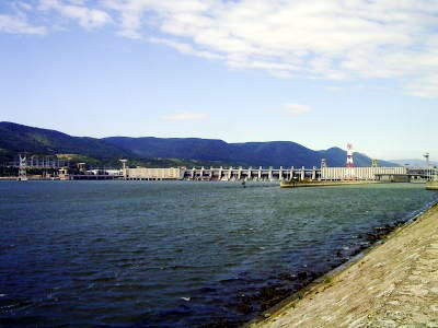 Staudamm ?Eisernes Tor“ Source:Deutsch Wikipedia Iron Gate, also known as Djerdap gorge (Serbian: Djerdapska klisura), is the largest river gorge in Europe where the mighty Danube had broke through the Carpathian Mountains for 90 km. It consists of four gorges: Golubac gorge, Gospodjin Vir, Kazan (here, the river reaches depth of 90 m), and Sip gorge as well as of three valleys: Ljupkovska, Donjomilanovacka and Orsava. Golubac gorge, Ljupkovska valley and Gospodjin Vir gorge are located in Golubac municipality. This is a territory of unique and grandiose beauty of total area of 1,236.24
ha with interchanging natural rarities and remains of ancient civilizations,
exquisite landscapes and geomorphologic traits with refugium specifics. Romania's President Train Basescu and his
Serb counterpart Borids Tadic discussed the harmonization of transportation
regulations on the Danube and the Rhine, at a meeting in Bucharest. Tadic
said, the Black Sea's Constanta Port has a special importance to Serbia.
He mentioned that the signing of a protocol on the Rhine-Main-Danube corridor,
which provides Serbia a link to Constanta, is very important to both countries.
Strategically speaking, he said, it is very important to have an agreement
on this issue, on a long term of 10, 20, 50 and even 100 years. He said
that the importance to Serbia of the Constanta Port is all the greater
as the Serb Danube fleet is very strong.
|